
Lindisfarne
Latitude: 55° 40'N
Longitude: 01° 48'W
Country: England
Type: Private
Usage: Leisure, Fishing
Contact name: Tommy Douglas, Harbour Master
Telephone no: 01289 389248
About Lindisfarne
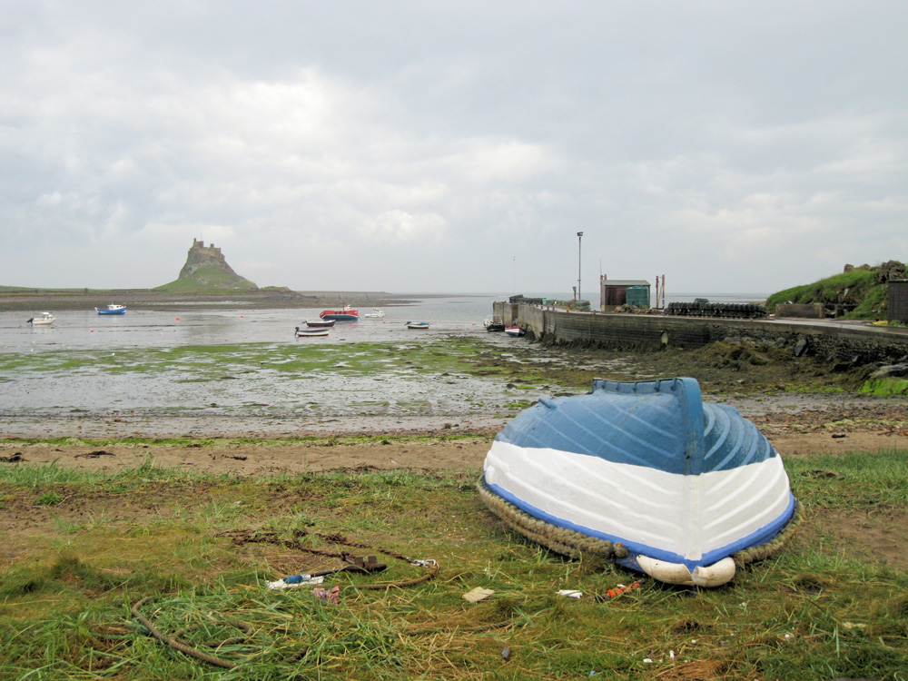
Holy Island harbour is characterised world-wide by pictures of the large, upturned fishing boats lining the beach. Now no longer seaworthy and used as work sheds for the small remaining seagoing fraternity, many of these boats were part of one of the largest herring fleets to sail off the east coast of England.The fishing fleet until the turn of the 19th century. It is often claimed (and even more often contested with nearby Craister!) that the first oak-smoked herring was prepared in the adjacent herring houses.
During the Industrial Revolution a small harbour was built at Lindisfarne to facilitate the export of coal and lime, and although there is still a harbour the jetty is private. The island is an impressively quiet and atmospheric tourist attraction providing one of the most beautiful settings in the British Isles. Fortunately the limited accommodation and the causeway ensure that it is never overwhelmed with visitors.
Return to Area Map