
Image © Richard Croft (under Creative Commons licence)
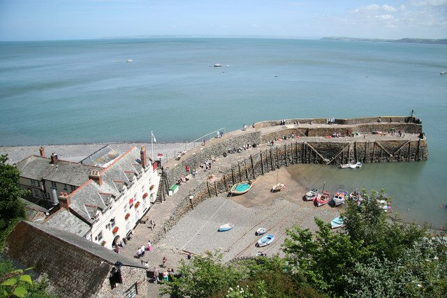
Clovelly
Latitude: 51° 00'N
Longitude: 04° 24'W
Country: England
Type: Unknown
Usage: Leisure, Fishing
Contact name: Stephen Perham, Harbour Master
Telephone no: 01237 431761
Website: www.clovelly.co.uk/harbou...rvices.php
About Clovelly
This ancient fishing village is mentioned in the Doomsday book (c.1100 A.D.) and it is probable that a settlement existed even in Saxon times.A 16th century lawyer, George Cary, built the stone harbour quay, establishing Clovelly as the only safe harbour between Boscastle in Cornwall and Appledore. The small harbour has sheltered up to 60 fishing boats, but due to the decline of the herring fishery this has now dwindled to a handful of small boats.
Return to Area Map