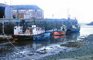
Port William
Latitude: 54° 45'N
Longitude: 04° 34'W
Country: Scotland
Ownership: Dumfries & Galloway Council
Type: Municipal
Usage: Leisure, Fishing
Contact name: Jimmy Brawls, Harbour Master
Telephone no: 01776 706266 or 07734 073419
Website: www.dumgal.gov.uk/index.a...74#William
About Port William
Man has been active on the shores around Port William for the last 6,000 years. There is evidence of a Mesolithic site to the south of the Port William signs of habitation and flints to the north. There are standing stones at Drumtroddan, just behind Port William, and cup and ring markings at Balcraig and Monreith. An Iron Age fort is sited on the headland at Barsalloch Point. There are old Christian sites at Chapel Finian and Barhobble. The Vikings have also left their mark on the countryside in some of the place names.In the seventeenth and eighteenth centuries, smuggling was rife, due to the proximity of the Isle of Man. The main company involved in this trade was based at Clone Farm, but many of the local farms had 'brandy holes' - hiding places for smuggled goods - some of which are still being uncovered today when foundations are being excavated for new buildings.
Captain Francois Thurot, the French privateer, smuggler and naval officer, a protege of Madam de Pompadour, is buried at the small churchyard lying beneath the golf course at Monreith. His body was washed ashore there following a sea battle with a British fleet off the north of the Isle of Man in 1760. He had been responsible for introducing the Order of Coldin to Sweden and this order unveiled a plaque to him at the churchyard. In 1967 a detachment of the French Fleet came there to honour him.
Return to Area Map

