
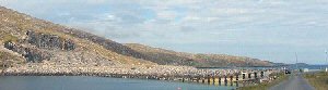
Caolis
Latitude: 56° 56'N
Longitude: 07° 31'W
Country: Scotland
Ownership: Comhairle Nan Eilean Siar
Type: Municipal
Usage: Fishing
Contact name: Calum Macleod, Harbour Master
Address: Technical Services, Comhairle Nan Eilean Siar, Balivanich, Benbecula, HS7 5LA
Telephone no: 01870 602425
E-mail: calum-macleod@cne-siar.gov.uk
Website: www.cne-siar.gov.uk/harbo.../index.htm
About Caolis
A landing site built in 1910 by the Congested Districts board shortly after they bought Vatersay from its previous owner Lady Gordon Cathcart. The landing site was mainly used for landing groceries for the local shop and by local fishermen.Before the causeway linking Vatersay and Barra was completed in 1991 this jetty was used whenever the ferry needed to offload a car. Nowadays it is little used, except by local fishermen.
Return to Area Map