
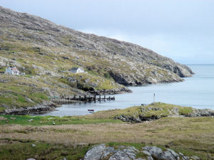
Kyles Scalpay
Latitude: 57° 52'N
Longitude: 06° 41'W
Country: Scotland
Website: www.cne-siar.gov.uk/harbo.../index.htm
About Kyles Scalpay
This slipway was the terminal for ferries across to the island of Scalpay. It became redundant in December 1997 when the bridge was opened.Return to Former Harbours Map