
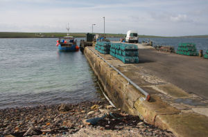
Burray
Latitude: 58° 51'N
Longitude: 02° 55'W
Country: Scotland
Ownership: Orkney Islands Council
Type: Municipal
Usage: Leisure, Fishing
Contact name: Capt Nigel Mills, Director of Harbours
Address: Harbour Authority Building, Scapa, Orkney, KW15 1SD
Telephone no: 01856 873636
E-mail: harbours@orkney.gov.uk
Website: www.orkneyharbours.com/burray_pier.asp
About Burray
Burray has a land area of just two and a quarter square miles, with a population of 363 persons (1991 census) and is connected by road to both mainland Orkney and South Ronaldsay by a series of Churchill Barriers, a reminder of recent history. The pier, which is in the main village, is used mainly by local fishing boats.Return to Area Map