
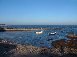
Rockfield
Latitude: 57° 49'N
Longitude: 03° 48'W
Country: Scotland
Type: Private
Usage: Fishing
About Rockfield
The jetty provides shelter for launching from the shingle beach. The area is used by a few local fishermen. Rockfield is a very pretty and sleepy old fishing village nestling at the bottom of the cliffs.Return to Area Map