
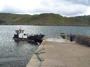
Kerrera Slip
Latitude: 56° 24'N
Longitude: 05° 31'W
Country: Scotland
Type: Private
Usage: Ferry Terminal
Contact name: Duncan MacEachen
Telephone no: 01631 563665
E-mail: kerreraferry@hotmail.com
Website: www.kerrera-ferry.co.uk
About Kerrera Slip
Known affectionately as the 'Kerry Ferry', a small ferryboat links the island of Kerrera to the mainland. Of course, prevailing weather conditions may force the cancellation of sailings. Sailing times can be seen here.The Isle of Kerrera Development Trust is actively encouraging tourism and development to this small island, the north end of which lies directly opposite the town of Oban.
Return to Area Map