
Wadebridge
Latitude: 50° 31'N
Longitude: 04° 50'W
Country: England
About Wadebridge
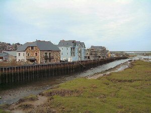
Up until the 19th century Wadebridge was an important port locally. The early 1833 mineral railway transported china clay and granite down from Bodmin Moor to be shipped out. Granite, dressed and exported from Wadebridge travelled as far away as Sri Lanka to build breakwaters and lighthouses. The name of the access road to the old port area (now substantially built over), "Eddystone Road", provides a clue to the origins of the granite used in the lighthouse off Plymouth.Gradual silting up of the estuary and the coming of the mainline railway at the end of the 1800s saw the demise of the port. Some boat repairs still take place at Wadebridge but the riversides are increasingly taken over for shops or upmarket accommodation.
Return to Former Harbours Map