
Ard Neakie
Latitude: 58° 29'N
Longitude: 04° 39'W
Country: Scotland
Type: Unknown
Usage: Fishing
About Ard Neakie
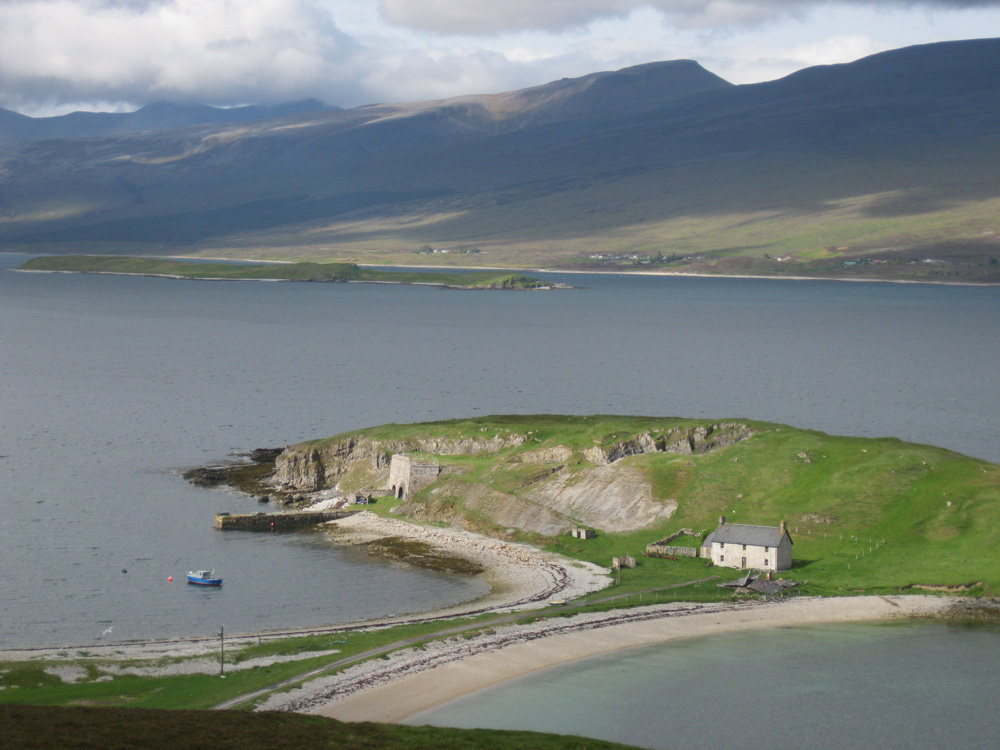
Loch Eriboll's most intriguing and attractive feature is Ard Neakie. This is a mound of land prevented from becoming an island by a tombolo of sand and shingle linking it to the east shore of the loch where the Tongue road descends from the moorland to the east.Ard Neakie was used as the terminus of the Heilam Ferry, which crossed the loch to the now gone Heilam Inn on the west bank of the loch at Portnancon. The ferry ceased operating in the 1890s when the road around the loch was completed, but the ferry house built in 1831 still stands, though sadly increasingly derelict. Ard Neakie is also notable for the four large lime kilns built in 1870. The Reay estate produced large amounts of lime here and on the nearby island of Eilean Choraidh and loaded it into ships.
The loch was used as a naval anchorage for much of the 20th century. Loch Eriboll was the site of the surrender of the German U-boat fleet in May 1945. Between the 10th and 20th May, over thirty U-boats came into Loch Eriboll. This is well researched in a book by David Hird.
Return to Area Map