
Image © Arnold Price (under Creative Commons licence)
Arnside
Latitude: 54° 12'N
Longitude: 02° 50'W
Country: England
About Arnside
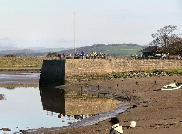
Arnside's port at the northern end of Morecambe Bay eventually lost its trade to other more accessible harbours. It still retains a pier, built by the railway company in 1860 to compensate for the new viaduct across the River Kent which effectively prevented shipping progressing any further upstream.The pier was destroyed by a storm, but subsequently rebuilt by Arnside Parish Council in 1983/84 at a cost of £25,000. It is no longer used, except by fishermen who use the end of the pier.
Return to Former Harbours Map