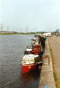
Connah's Quay
Latitude: 53° 13'N
Longitude: 03° 05'W
Country: Wales
Type: Unknown
Usage: Leisure, Fishing
About Connah's Quay
The town of Connah's Quay began to develop some two hundred years ago, on the banks of the estuary of the River Dee, in the parish of Northop.With the silting up of the River Dee following the construction of the “New Cut” in the 18th century, Chester ceased to be a port and the business was transferred to what is now Connah’s Quay with its direct rail link to the coat mines and potteries of Buckley. By the mid-Victorian period, it had become a busy port, with a thriving ship-building industry.
The dock area has been refurbished, largely by voluntary efforts, and the riverside marina was opened by the Princess of Wales in October 1981.
There are moorings for a good number of boats and the Sea Cadets have their headquarters here.
Return to Area Map


